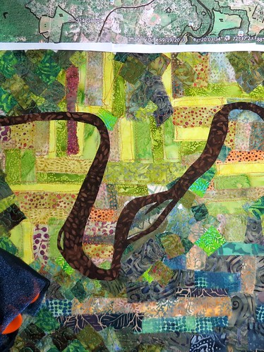
For some reason, when I show the river, it is always brown. It shows up brown or black on true color satellite images, which I worked with for a while, a long time ago. It shows up brown when I fly over it in tiny planes out of the local tiny airport. It looks brown (with some green) when I go over the bridge to and from everything. And yet every cartographic instinct I have tells me that water is always blue. It is what we call a cartographic convention. And I am so torn!!
Above you can see my lovely brown river (maybe it was from hearing the Just So Stories involving the great, gray-green, greasy Limpopo River) and while I love it, I also think it is not quite correct.
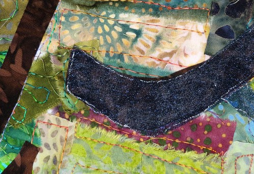
So I tried an experiment overlaying a dark and sparkling blue organza over that brown. It looks like so:
Since I am not at all sure, I thought I should maybe let it rest until tomorrow, when I will have had sleep.
Five a.m. is for the birds.
