Moffen Island

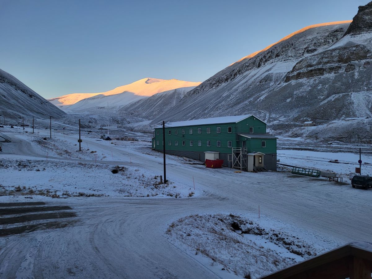
Friends, I have to admit that a couple days into the trip time started to go entirely wonky on me. I can almost trace out our journey on the tourist map of Spitzbergen/Svalbard (the entire archpelago – the town(s) are Longyearbyen and assorted others) but the days are only loosely connected to the trip. So I am pulling sections from my journal of things that stuck out to me.

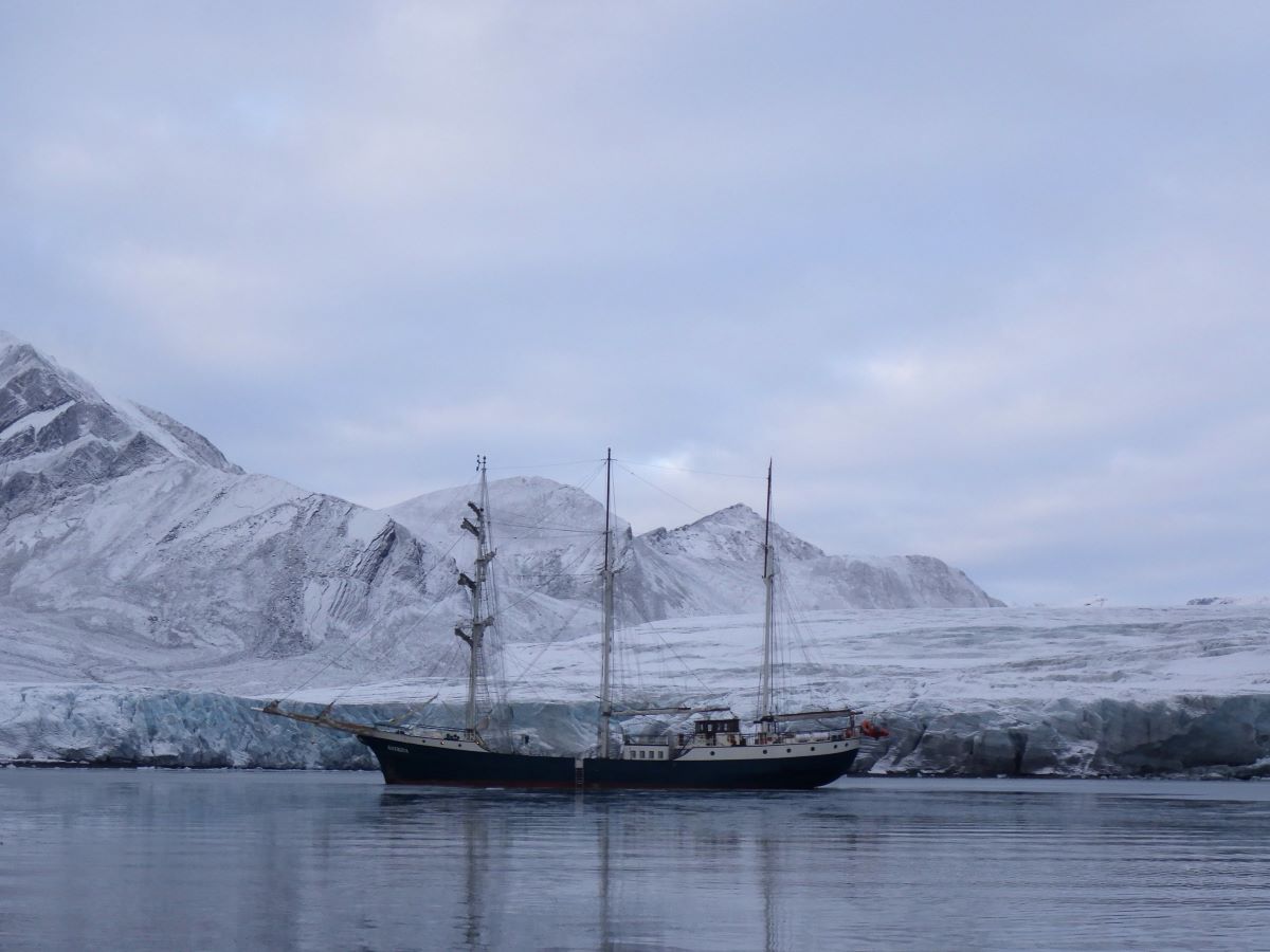
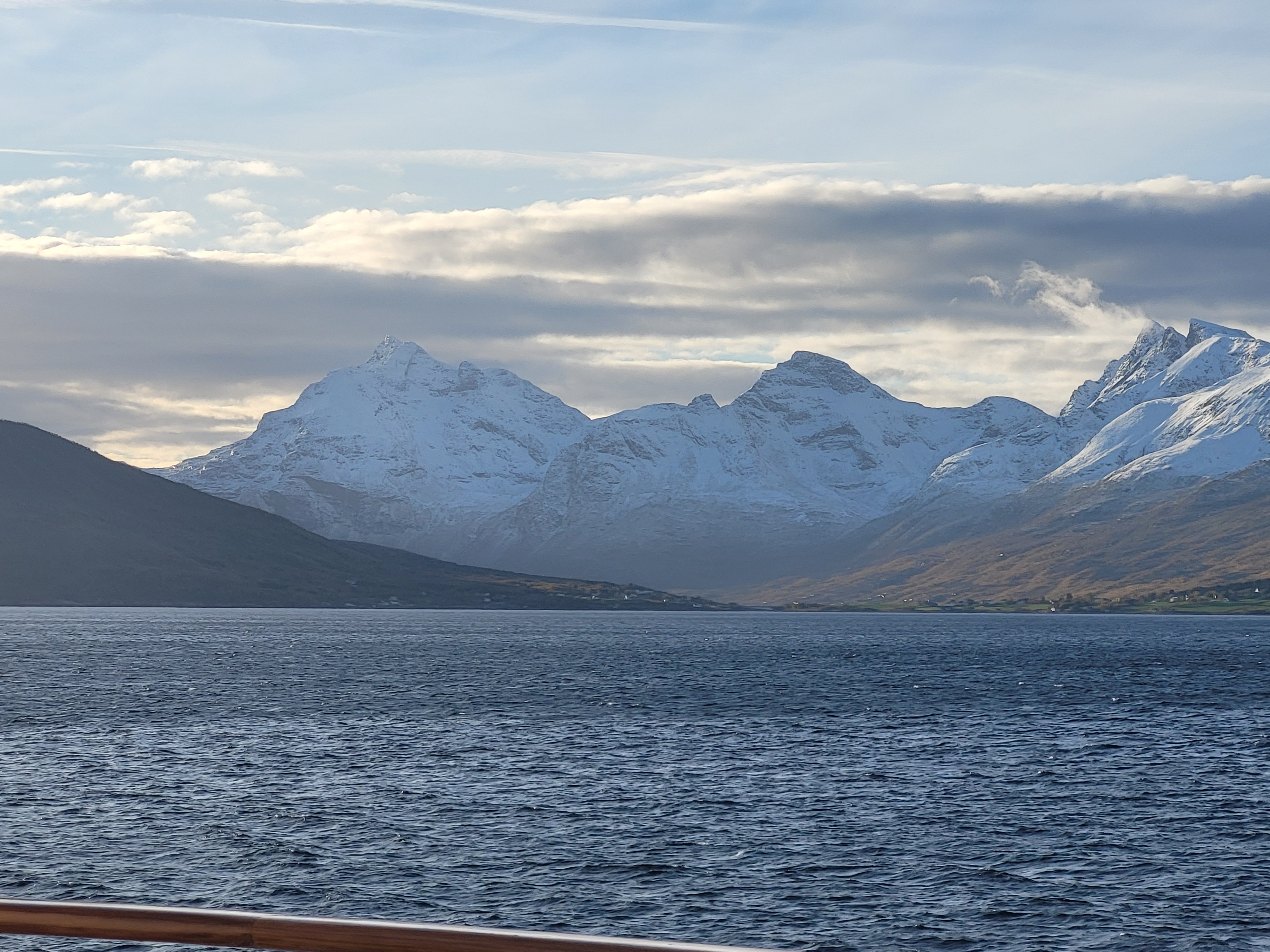
We stopped in another fjord further north, ringed around with tall peaks. I got up around 3am because I could see stars out of our porthole. Once on deck (swathed in my down coat) I could find the Big Dipper, and from there Polaris. It was wild to have to tilt my head so far back to see it – the difference between 80° off the horizon and zenith (directly overhead) is hard to see! I finally found Orion by waiting til his belt showed over the mountains (I never did see his feet) and from there located Procyon, and Aldebaran. While I was staring at stars, I was wondering what town was producing light pollution on the horizon, until I realized it was aurora. It was faint and flickery, but present and lovely in the cold night.

The next morning we dropped off the intrepid hikers among us (about half) and they hiked across the peninsula to meet the ship on the other side. The rest of us did projects ashore (everyone else) or drove around in the zodiac looking for arctic foxes and interesting ice formations (me), which was fun. The 3rd mate and I saw fox tracks, but no fox, while the people at the landing saw two, one in winter colors and one in summer colors. Mid afternoon we upped anchor and went around the point and anchored at a hut on the shore. We could see the hikers coming over the pass between the hills, tiny dots against the landscape. It took hours from seeing them to them actually arriving, and picking them up.

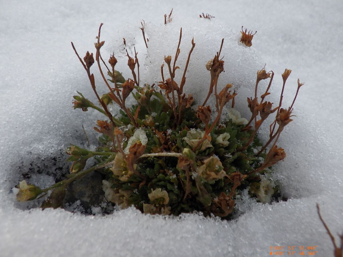
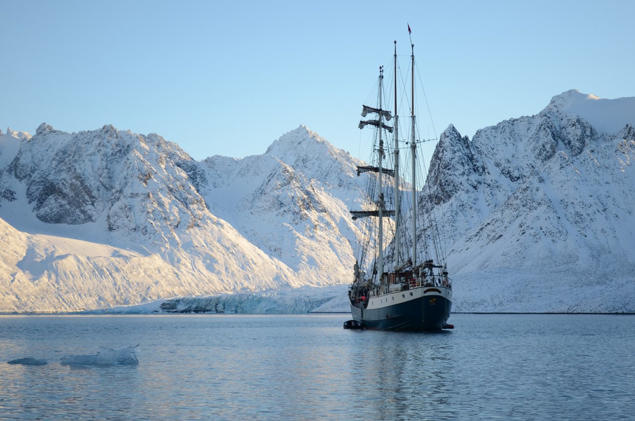
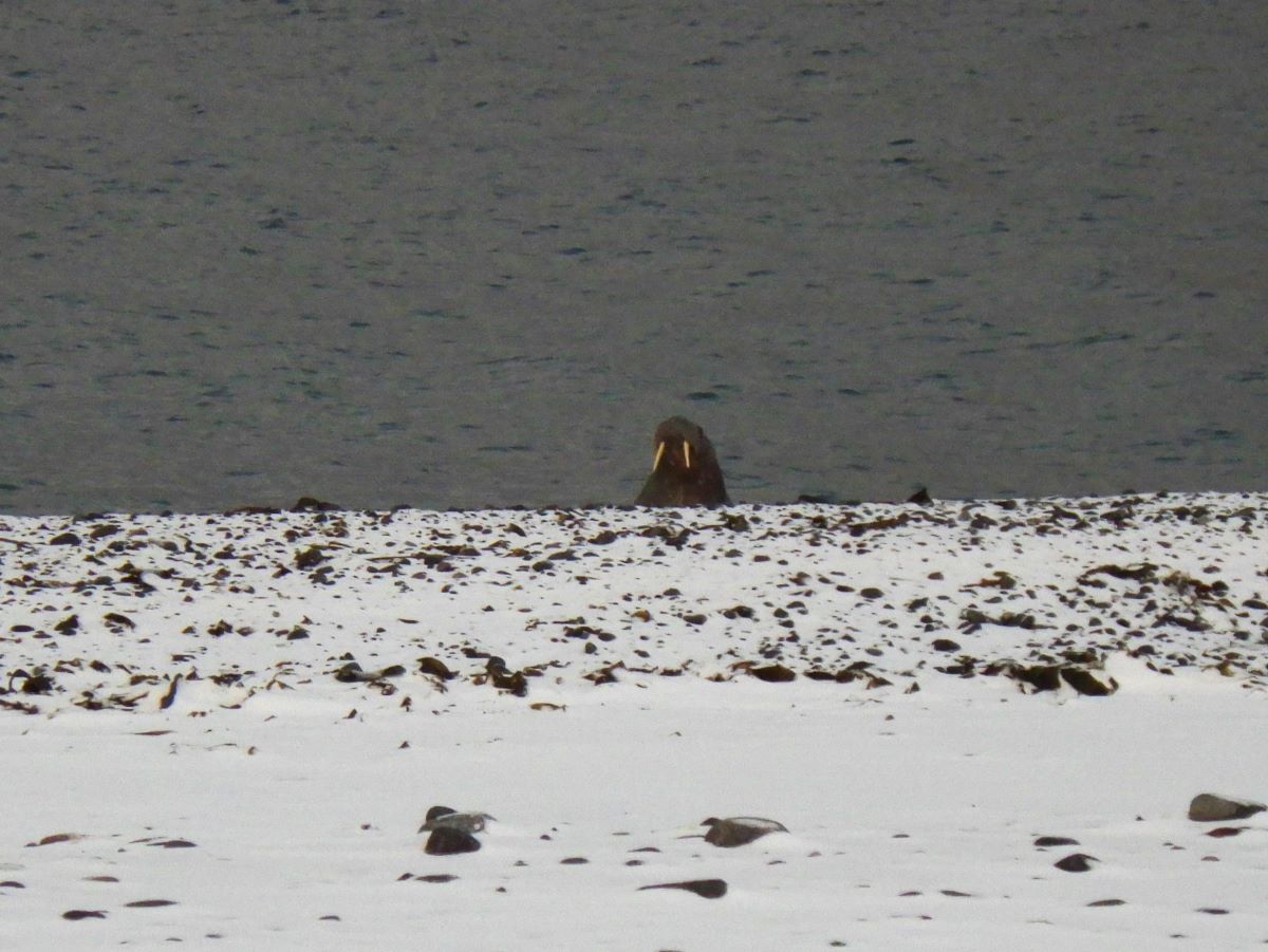
Once we had everyone aboard again we went north. Really, thoroughly NORTH. We went up over the top of the main island of Spitzbergen, and further north than that is a strange island that feels in the middle of the ocean. It is actually part of a large delta, from several large glaciers melting back a lot (not in human history, before that). It is a funny low, round island with a pond in the middle, so it is shaped like a low flat donut, composed entirely of rounded stones between head sized and sandgrains. It is where walruses breed, so it is closed to everyone during breeding season, but we were slightly less than a week past breeding season, so we went closer, to find a place to anchor. In circumnavigating Moffen Island we found a large group of walruses (herd, pod or haul are the usual collective nouns) hauled out on the beach, jostling each other like teenagers. We anchored slightly north, and everyone wanted to land. Once ashore, half of us went right, to see the walruses up close, because too many would be distracting, and the other half went left, to draw, take pictures or make performance art. We were as far north as we would get, there was nothing between us and the North Pole except 10° latitude of ocean and ice. It was beautiful, and desolate. While we were walking I kept lagging behind to look at all the small perfect stones, and one (possibly two – individuals were hard to ID) walrus(es) swam along the beach watching us. At one point one hauled himself partway up the beach, to peer over the berm. It was astonishing. The people who got closest to the haul of walruses at the other end of the beach said they were jostling each other constantly, and smelled of fish and farts.

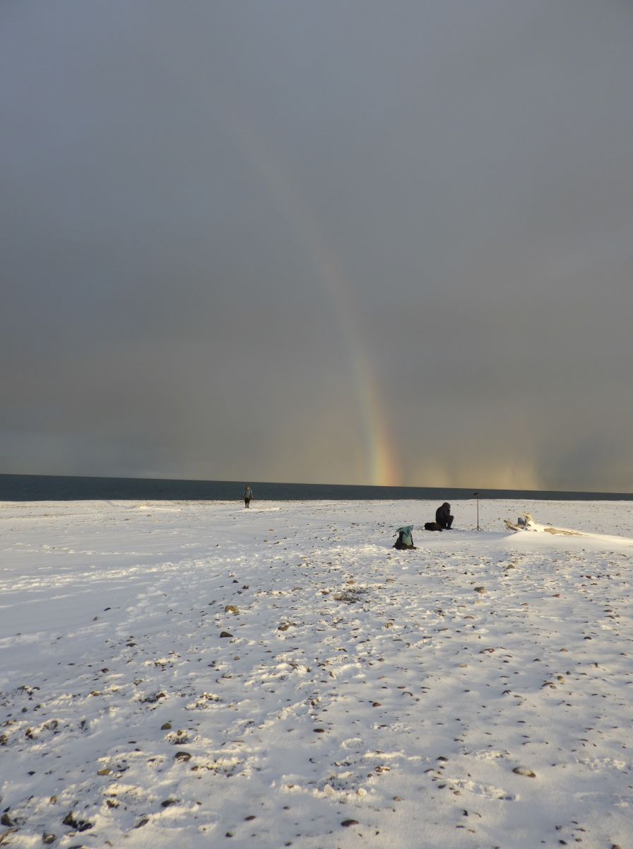
While we were there the sun came out from behind clouds in the south and shone across Moffen and towards the snowsqualls in the north, making a high faint rainbow in the snow. We weren’t sure what to call it – snow-bow, rainbow – but it was magical. I had the foolish thought that if I backed up far enough I could get it all into the camera view, but eventually decided it wouldn’t work quite that way.

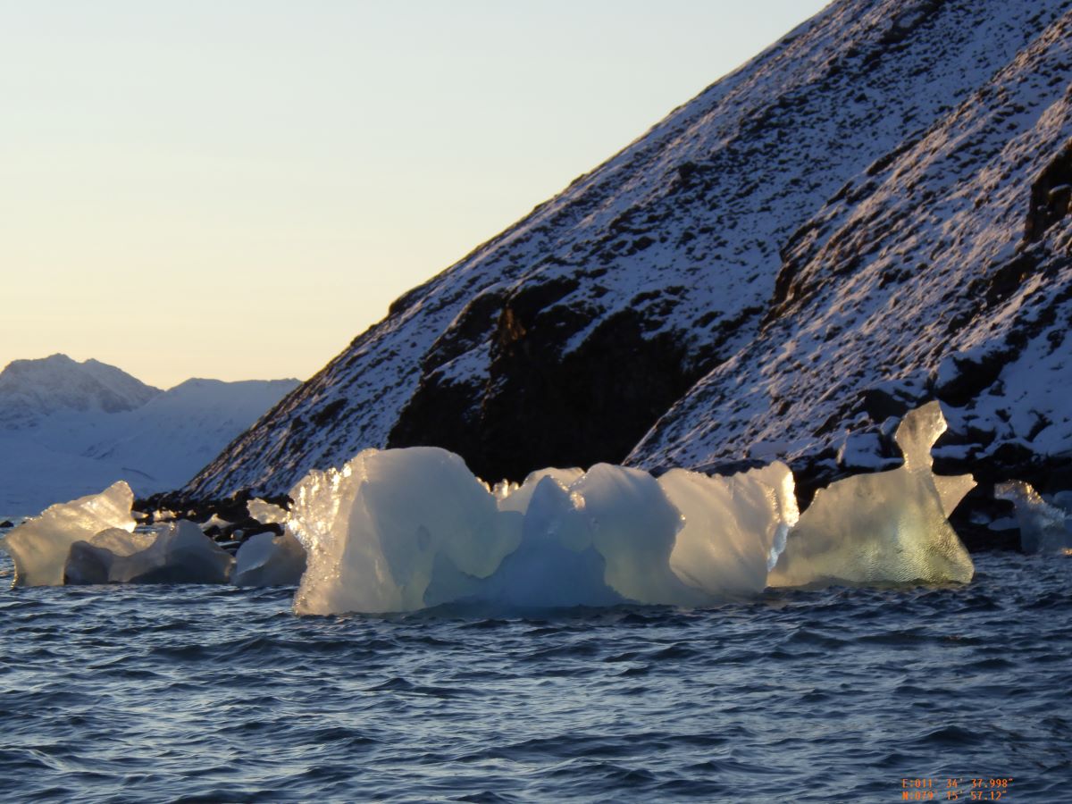
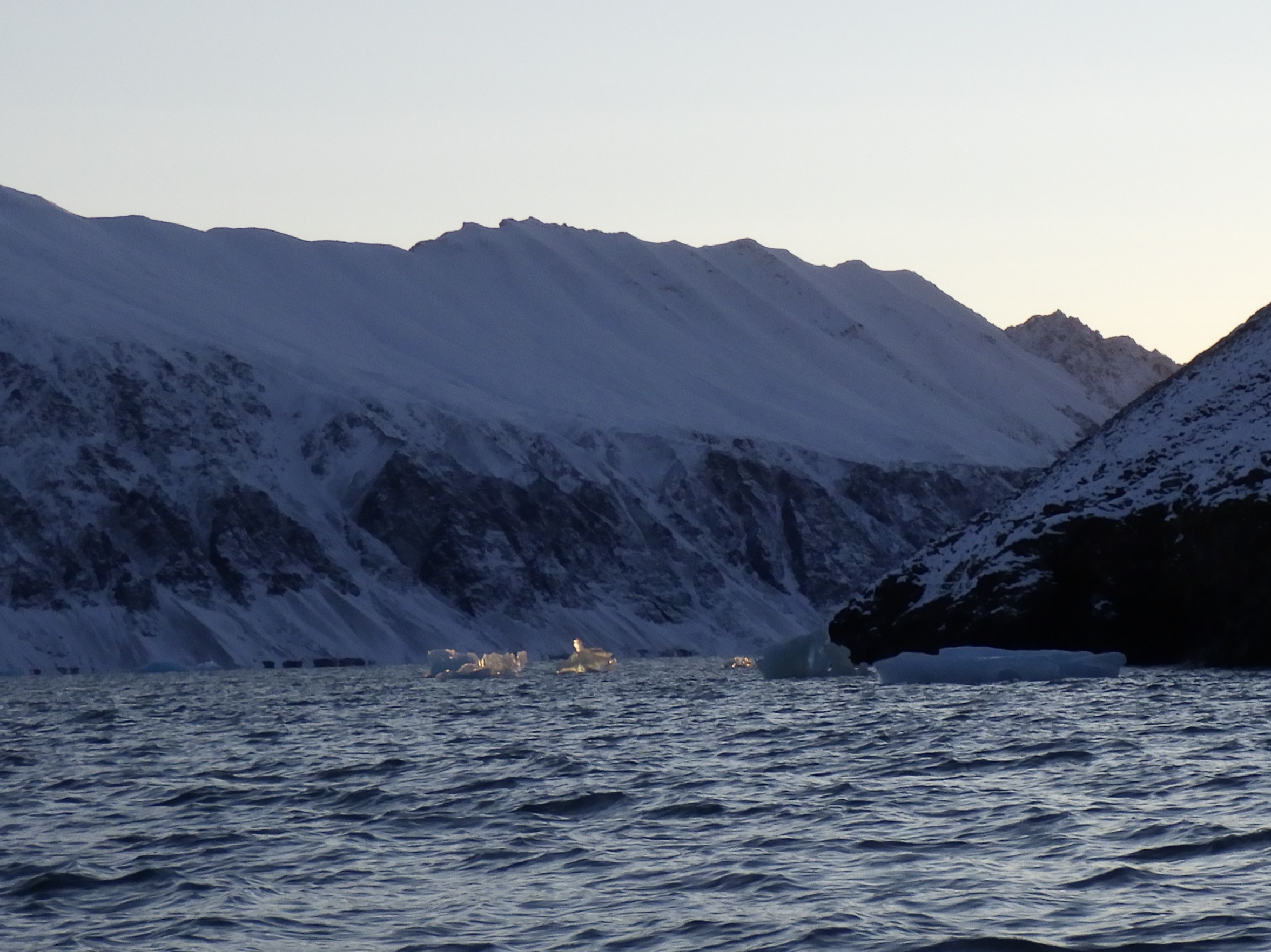
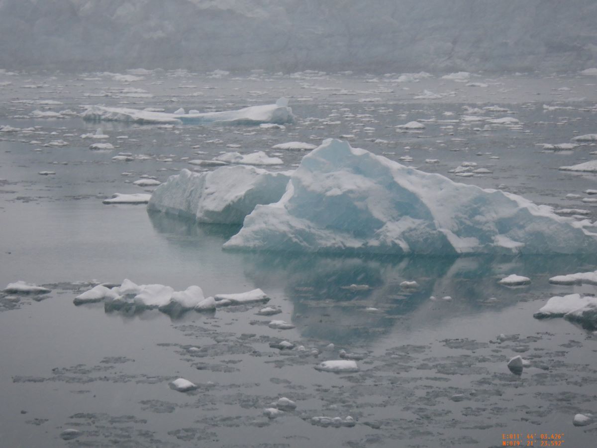
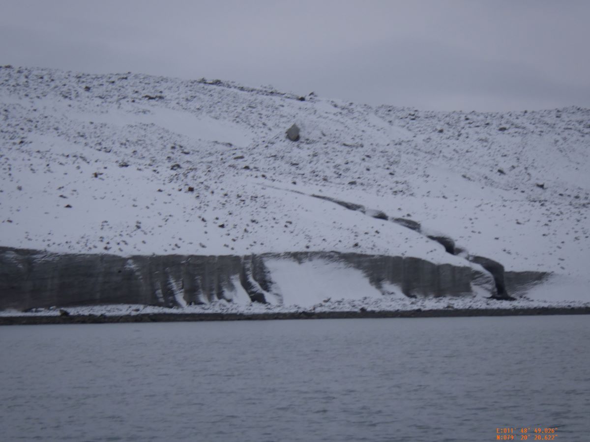
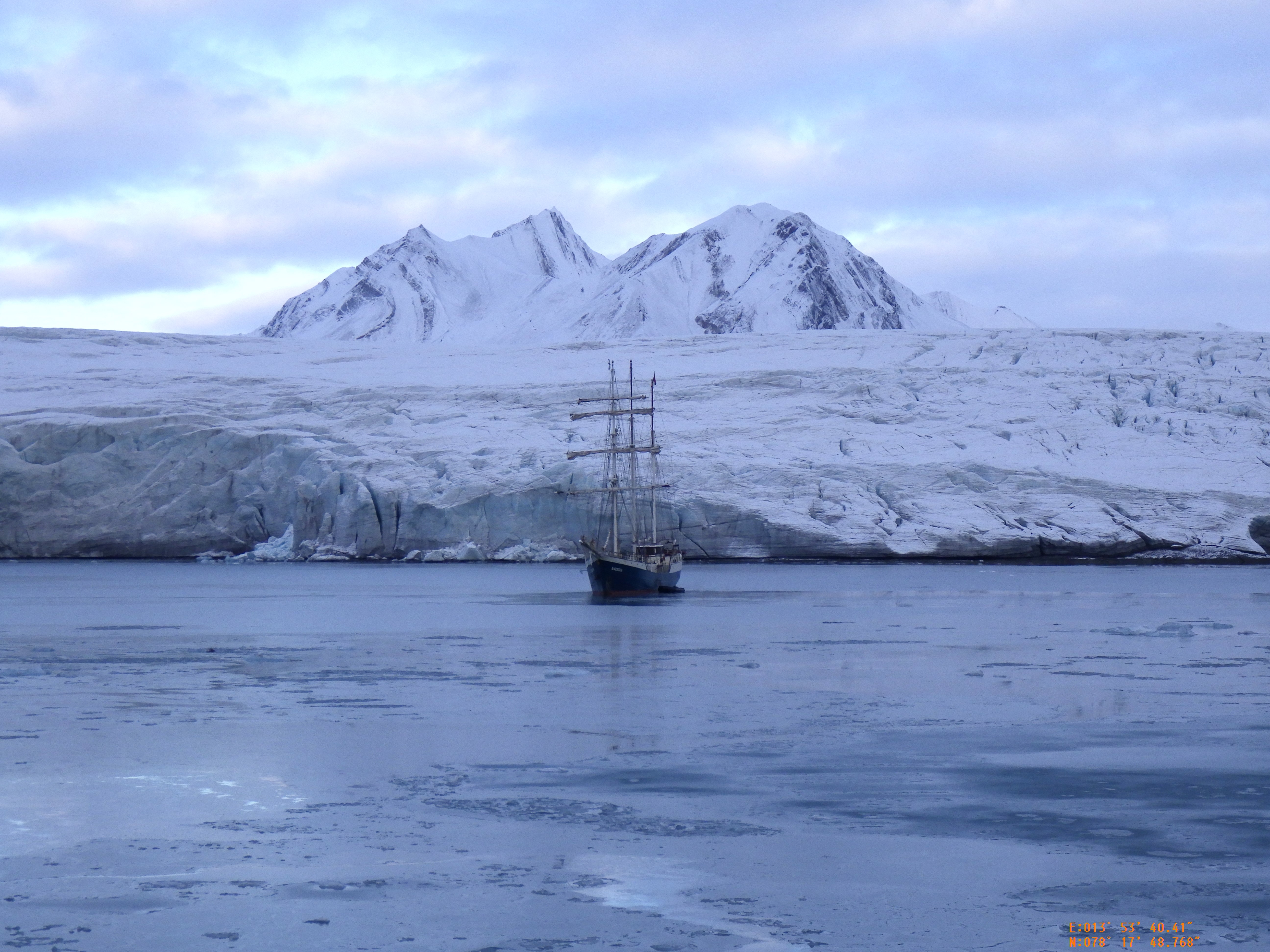
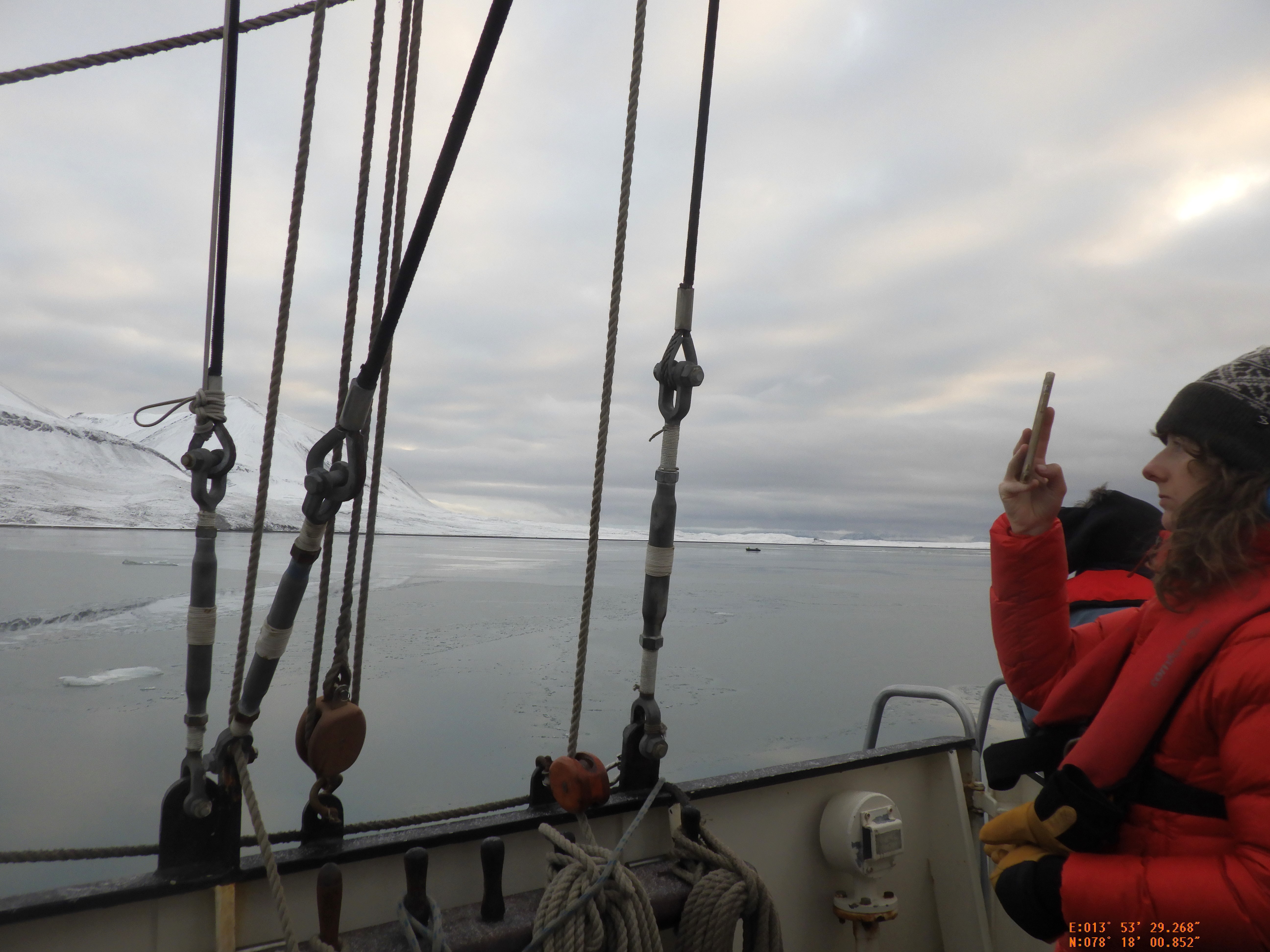
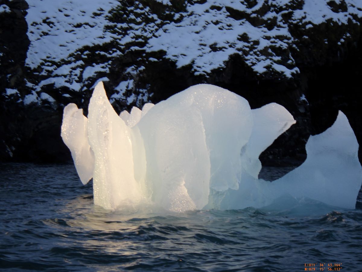
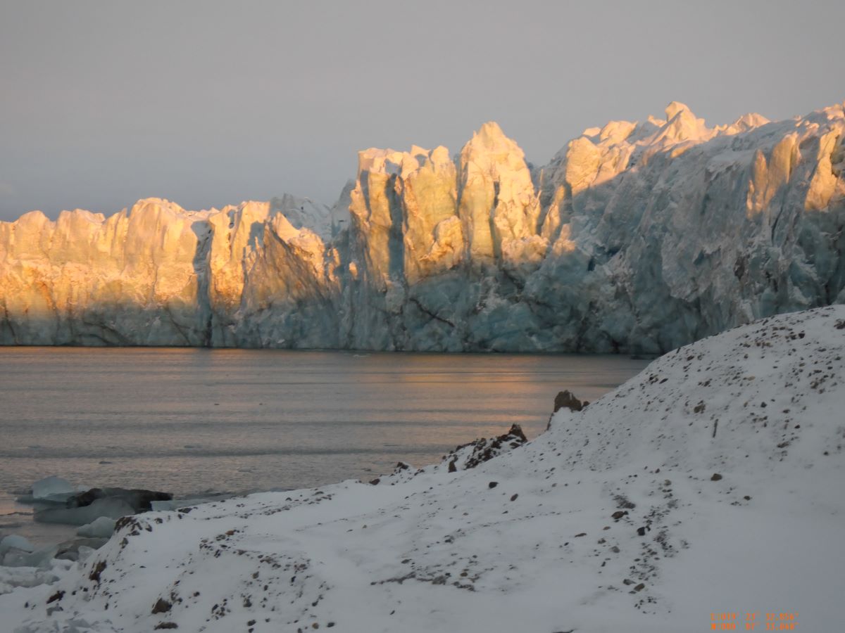
We left Moffen with some regret, but there was weather coming. We went south (everywhere is south from there) and east, to Nordaustlandet (Northeast Island) and found Lady Franklinfjorden. When Franklin was lost, his wife poured money into high latitude exploration hoping to find something about where he’d gone, and people exploring in her name would name things after her. There was a glacier there with edges we could hike up to, and more ice in the ocean. We went ashore and climbed about in the moraine area, and some went closer to get a better look. Because it was going to blow hard from the east, the captain took us around the corner to Murchinsonfjorden, and brought us deep into the center of the island. It took two anchors to hold us, even with tall peaks all around. The 2nd mate confidently assessed the wind at Beaufort 8, which is 35-40 knots and a Full Gale. The wind whistled in the rigging, and there were whitecaps in the small harbor we were in. The sound people had a field day recording the wind humming and moaning around the ship. When the wind dropped later in the afternoon the intrepid ones went ashore to hike up high enough to see the ice cap in the middle of the island. They turned back early because their guide saw a bear, though no one else did. Later she swore with a straight face that she was just tired of walking, but we are all pretty sure she did in fact see a bear. That was the only time we had to retreat for a bear, but we had the guides there with us all the time to keep us out of exactly that sort of trouble.

Further North

From Longyearbyen we crossed the big fjord, called Isfjorden, to a little fjord on the other side. We could look back and see the lights of Longyearbyen low on the horizon, but it was cloudy and windy and hard to stay on deck for long. I also felt like I was still getting used to how many layers of clothes I needed to keep warm – temps around freezing in New England generally have sunshine at noon, temps around freezing feels entirely different. I am grateful for my new puffy down coat (I bought it in Longyearbyen, realizing I needed it!) and all the layers of long underwear I packed thinking I wouldn’t need them all. We slept that first night in the fjord, and woke to find sea ice beginning to form all around the ship. It was thin and slushy, and made shushing noises against the hull.

We practiced our first landing, all the parts we need to know. How to get into the zodiac, what to hold onto, how to get out on the beach (the big waterproof boots make so much sense – we always wade ashore in relatively shallow water, no stepping dryfooted onto the beach), where to go and not go (do not get between the guides, stay inside the perimeter, so they can keep us safe) and then how to get back into the zodiacs and back on board Antigua safely.

We were relayed ashore in groups of eight, stomping and splashing ashore, and then separating to see how hard it would be to accomplish our personal pursuits. I tried drawing some of the landscape in my sketchbook, and couldn’t hold the pencil for very long. I put everything away and just walked along the beach, and then up over the small headland, looking at the geology (layers of very fine dark sandstone, tipped entirely vertically, easy to break along bedding planes). The big waterproof boots are also valuable for marching through snow, and supporting one’s ankles when tripping on things.

We were in the end of a small fjord, and ice was forming on the surface of the ocean, and the zodiacs had to do a tiny bit of ice breaking, and the sound it made was delightful. A sort of shushing over the surface. Over the course of the morning, the ice built up some and we had to do more ice breaking to get back to the ship. That was more crackling and crunching, as we’d smash through the thicker ice, or brush through the thicker pieces already broken up by the previous zodiac.

After returning to the ship, I think everyone had to reassess what they would be doing for the trip. So many of us came with large plans for work to do on land, or with snow or ice. I feel relieved that my plan for recording what I see and taking it home for notes for later work will work nicely, as will my plan to stitch a small piece about each day.

I continue to be amazed by the geology that is visible everywhere I look. There are the visible layers of depostion, there are places where faults can be clearly seen, and the edges of so many of the mountains are the edges of the bids, curved and tilted to form great swoops of rock, dusted with snow to emphasize the curves, and the darkness of the underlying rocks.

We headed out of Isfjorden completely, and north along the western edge of the main island, and found a small fjord further up. That was a night’s travel to arrive there.

We woke to endless floating bits of ice – bergy bits. They ranged from the size of an ice cube to the size of the zodiac (about 6m (18 ft) long and about 2m (6 ft) wide) and were all shades of blue, and from glass clear to white with bubbles. There is a distinctive noise around floating ice, the steady lapping of water at the waterline. I stayed on the ship in the morning, while others went ashore to admire what we dubbed Diamond Point. There were blocks if ice grounded there from the glacier further up the fjord, and they gleamed in the intermittent sun. I did go ashore in the afternoon, and after a quick sketch of the surroundings I wandered along the shore, throwing rocks into the ocean and practicing skipping stones.

We moved again in the night, further north, to a fjord with two arms of glacier separated by a big medial moraine and possibly some bedrock. Here I joined a zodiac cruise around the ice, both the big ice that was grounded near the front of the glacier and the big and small pieces of ice floating about in the bay in front of the glacier. I was in the boat with the people who were trying to video, and we were trying to be quiet, and my camera and my phone were both making a lot of little peeps and beeps that were making me feel extremely self concious, but two of us were both just faffing about while people like Paola were actually trying to do things like record and Josh had a camera on a stick that could go into the water – he unfolded the stick and poked it firmly into the water near the coolest of the grounded ice. I remembered my orange camera is waterproof and stuck it into the water until my hand was too cold to feel. It recorded water that was thick with rock flour from the glaciers, and hard to see anything through, but it was at least an interesting color.

After lunch Antigua upped anchor and we cruised along the face of the glacier, at a respectful distance, and peered at it through the snow, flakes falling over us, and on the deck and the floating ice, and in between us and the glacier. Steph and I were hanging over the rail staring at (and photographing) the ice in the water and the glacier across the water through the snow, and thinking about how to paint it or portray it in fabric. I feel like I packed exactly the right fabrics for this trip, heavily skewed towards all the blues and greens.

We go on a ship

We arrived on the ship on Thursday afternoon, and after a quick orientation, everyone settled into their staterooms (we have staterooms – and in fact we have beds, with legs on the floor, and space under them to hide extra gear) and stow their gear. My bunkmate and I both had the same emotional moment standing there in our little room, realizing we are really here, in the arctic, on the boat, setting out on this enormous adventure.

We left Longyearbyen just before supper, so we ate underway and talked about how the trip would go.

We have four guides, and we are not allowed ashore without them. They have rifles and flare guns to protect us hapless artists from encroaching wildlife, mostly polar bears, and walkue-talkies to talk with each other and the ship, and backpacks full of emergency supplies and extra warmth and goodness knows what else. Our fearless leader is Sarah, and possibly the most frequently said words on the ship are “Sarah says…” We joke about her being a professional badass, an arctic superwoman, but as the trip has gone on, those jokes feel closer and closer to the truth. She is assisted by Tuomas, Lars and Sanna. Together they scout landings, set up perimeters, and oversee us working, or they accompany small groups of us as we move about. A substantial portion of the participants are able hikers, and looking forward to walking in the arctic landscape.

For artists, we have a broad array. A handful of people are collecting sounds for different reasons – to builds sounds for synthesizers, for manipulating into music, or as part of performance work. There are a couple of people painting, one composer, and then the photographers. No one is not taking pictures. Cameras range from very large, with gimbals and stabilizers, to DSLRs with extravagant lenses to everyone else taking pictures with point-and-shoot or phones. I am the only person stitching, but there are a lot of people knitting, including two of the guides and one of the mates. We have thirty artists, our guides and the ship’s staff.

The ship, Antigua, has as many people running the ship as there are people looking after us, which surprised me. We are very much passengers, fed and looked after by a capable crew of four – one cook, and three “service” staff. Four more people make the boat go; a captain, and three mates. There is no chance to take the helm, because we run mostly by autopilot, but we can, and are encouraged to, help with sail handling. The mates are the people running the zodiacs (we have two) between the ship and the landing sites, and stand watch when we are underway at night, as well as doing the ongoing boat maintenance. When I wake up at 3am to check on stars and auroras, I can hang out in the wheelhouse with First Mate Hans. We don’t talk much, but it is nice to be close to the mapper and see what is out there on the radar and the depth sounder.

From Longyearbyen

I noticed as I travelled further north that the snow on the tops of the mountains was gradually drawing down closer and closer to sea level. When I left Tromso, the snow line was maybe 200 ft up the sides of the mountains around the town and fjord. When we reached Svalbard, we had entered winter completely. There is snow on the roads, snow on the hillsides (all either vertical crags or rubble at the angle of repose) and snow drifted lightly across the rooftops.

I found some of the Arctic Circle people who had come in on my plane, and we were found in turn by the Expedition leader Sarah, and shuttled uphill to the Coalminer’s Cabins. Svalbard was a coal mining outpost for America briefly (Longyearbyen is named after an American, Longyear, who started the mining operation here – he later sold it to the Norwegian government. Byen is town – Longyearbyen is Longyear Town, Nybyen is New Town) and then Norwegian. There are two Russian outposts where they mined coal – they were abandoned in the 1980s, and then dusted off and repainted after the war in Ukraine started.

After settling in some, I walked down the long hill to town. Svalbard, the entire archipelago, has a year round population of 2500 – roughly equal to Smith College’s undergraduate population. They are well equipped, with a library, hospital, daycare and school, and even a branch of the Norwegian University system. I found the coop, where groceries and alcohol are sold, and two outfitters with all the things you need to be comfortable in this environment. I realized I would not be warm enough with just the clothes I had, even counting all my long underwear and sweaters, so I found a down coat that is almost as spherical as Al’s old Michelin Man coat, that he swore was as warm as not getting out of bed in the morning. I think that will help with the cold problem.

I am starting to think of the projects I brought – a small kit of gouache for painting quick sketches, and a stack of fabric in assorted colors to make little stitched images. Now I am wondering if the water in my paintbrushes is going to freeze! Stitching I can do on the ship, in the warm.

Gateway to the North

I have taken planes, trains and a jaunty big red ferry over the last several days to arrive at Tromso, Gateway to the North (it says so on the signs). From here I catch a bus to the airport, and a plane to Longyearbyen on Svalbard, at which point the official part of the trip begins.

I’ve been practicing sketching rather than snapping pictures. That is a hard habit to fix in place, only partly because the sketching and painting move much more slowly than the scenery. A fellow sketcher sat with me yesterday and we sympathized on how hard it is to be realistic, but also how little it matters later – we have a memory of staring at the landscape and producing a representation of it, and caring too deeply about “correctness” rather than over all impression is a mistake.

To that end, have some pictures from the ferry:

North!!

I am headed north! Accepted into the Arctic Circle Residency in March 2023, I have been as patient as possible. It was hard. I leave tomorrow for Norway, and a slow trip north through the country. I join the program Oct 2 in Longyearbyen, in Svalbard, and we set sail on the Antigua. I am one of roughly thirty artists, writers, musicians and scientists aboard. We all have some projects in mind. I have my little painting kit, and a compact stack of colorful fabric to applique, and I will be making notes for larger works to be accomplished once I return home again.

I’m packed. I’m ready. I cannot wait!

end results

All the linework turns into these little guys. Locals might recognize the distinctive bulge of Hadley, or the Oxbow lake just south of Northampton. The two on the right show the Deerfield river confluence, and the islands in Sunderland, down to the big twist in Hatfield.

I’m working on some new coastlines too – coming up soon.

new river sections!

When I start choosing new sections of river to build into boxes, I have to start with digital data. I have a digital elevation model (DEM) and sections of the national database that includes rivers, water bodies and flow lines for streams. When I get it all into a geographic information system, it looks like this:

I use an open source GIS called QGIS, and it lets me see the layers I have, manipulate them, and extract the area I am interested in. Here you can see elevation (brighter is higher elevation) and the rivers and waterbodies along the Connecticut River. The big blue lake is Quabbin Reservoir, where Boston drinking water comes from.

Once I have the pieces of landscape I am interested in on the screen, I export a file of linework. It looks like this:

Then I make a little box, and clip out sections of the river that will be turned into little boxed landscapes. The end result looks like this:

If you look closely at the little boxes, you can figure out which sections of river they are.

This is the first half of the process. Once I have linework, the laser cutting can begin. I’ll show that next week!

Field Trip!!

Alice and I took advantage of gorgeous weather and went down to Mystic Seaport to see both the ships at the seaport and also the Wooden Boat Show that was happening at the same time.

There were a lot of really lovely boats. Big ones were along the docks in the water, for touring if you were thinking about buying them. Little ones were everywhere – on trailers or stands on the common, in the water along the docks, with people standing next to them to explain or answer questions.

One Greek history aficionado had built a kind of mini, one man trireme, with a foam rubber ram on the bow and an extremely complex way of organizing the oars. There were a lot of catboats, of various sizes. The Cocktail Class tiny powerboats had a full squadron in attendance. Mostly they were sailing boats of various sizes, but we saw one big motor-sailer and a lightly renovated fishing boat that were also delightful.

We went to a lecture about how the seaport was repairing the sheer of LA Dunton, a Gloucester fishing schooner built in 1921 and acquired by the seaport in 1972. They’d done some renovations on her in the 1980s, but her sheer – the long line that defines the top of the hull – had become horribly hogged (bent the wrong way). They had made a plan to fix it, starting with detailed drawings of what she had looked like in her youth, drawn in part from photos. Then with plans in place, they’d hauled her out the water and onto the hard (preparing a dead level, two foot wide, concrete pad for her to sit on) and started the next steps. Which were to get everything out of the hull – all the interior walls, the concrete ballast (broken up with a jack hammer and removed) and any remaining bits. The ballast had extraneous bits of metal thrown into it to make it heavier, and they had a small display of broken handles, bits of wrought iron and also a cast iron skillet. After the interior was entirely bare, they could look at the hull and see what kind of shape it was in. It was in very rough shape.

The short story is that they had to loosen up some parts of the hull, notably the keel, so that the ends of the ship could be jacked back into place. Once the jacks were set, they started lifting the bow, and inch or two every day, until after a month they had lifted it three and a half feet – nearly forty inches. And then they built a giant staircase up the outside to let visitors come look, and because they are working on ADA compliance, they also cut a hole for a little three person elevator to go up into the interior. Which is where some of the photos above came from. Look at the gaps in the planking, and notice too the number of holes and pegs holding planking onto the big ribs. Essentially they are taking the ship apart and rebuilding it exactly the way it was originally built.

summer camp crafts

After putting the main sewing machine back together, it feels like time to just… mess around. I have a couple big projects looming, but I also worked hard during the beginning of the year to to get a show ready for the local library. Which morphed into another show at Northampton Bicycle, and a third show of work done while sailing last year at Zea Mays Print Studio. I am deeply grateful to have these venues to show my work. I am also grateful for some time off to just experiment.

To that end, I have made a string of dots for Dot’s Market in Northport, ME (just because I love them) and also my mother (because I love her too). My partner said “those are just frivolity on a string!” which is exactly what I was aiming for. I have been experimenting with larger circles in return for gifts from other artists. And I am taking a watercolor painting class to see if I like it (and might get better at it).